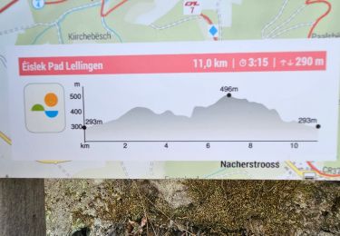
![](/images/other/stat-length.png)
![Randonnée Marche Parc Hosingen - Escapardenne Lee Trail: Hoscheid - Kautenbach - Photo](https://media.geolcdn.com/t/1900/400/8bf23a72-7eca-4436-91e5-2141dda4e2a9.jpeg&format=pjpeg&maxdim=2)
Escapardenne Lee Trail: Hoscheid - Kautenbach
dauzata
Utilisateur
![Longueur](/images/other/stat-length.png)
![Altitude max](https://static1.geolcdn.com/siteimages/upload/files/1508320355ic_sort_altitude_max_24dp.png)
![Dénivelé positif](https://static1.geolcdn.com/siteimages/upload/files/1508320355ic_sort_den_pos_24dp.png)
![Km-Effort](/images/other/stat-length.png)
![Altitude min](https://static1.geolcdn.com/siteimages/upload/files/1508320355ic_sort_altitude_min_24dp.png)
![Dénivelé négatif](https://static1.geolcdn.com/siteimages/upload/files/1508320355ic_sort_den_neg_24dp.png)
![Boucle](https://static1.geolcdn.com/siteimages/upload/files/16400158638029165_repeat_loop_refresh_sync_direction_icon.png)
![Marche](https://static1.geolcdn.com/sitytour/trail-icons/101.png)
4h25
Difficulté : Moyen
![Scannez ce code QR pour ouvrir la randonnée dans l'application SityTrail](https://capi.geolives.com/qq0zvz2zws4bq2lad0pu/sitytour/trails/3308970/qr.png?size=200)
Application GPS de randonnée GRATUITE
À propos
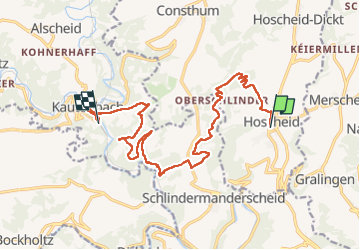
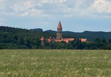
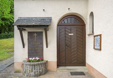
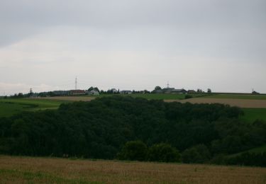
Randonnée Marche de 15,5 km à découvrir à Inconnu, Canton Clervaux, Parc Hosingen. Cette randonnée est proposée par dauzata.
Description
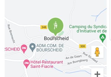
Départ: Hoscheid, route principale (Haaptstross).
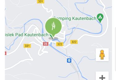
Arrivée: Gare de Kautenbach.
Possibilité d'arriver à Hoscheid depuis Ettelbrück via le bus 137 ou 170, arrêt "Hoscheid, Kräizgaass" ou "Hoscheid, Braaken".
Possibilité de retour vers Ettelbrück ou Clervaux via le train depuis Kautenbach.
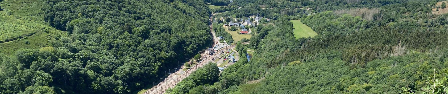
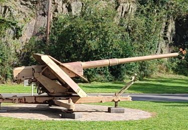
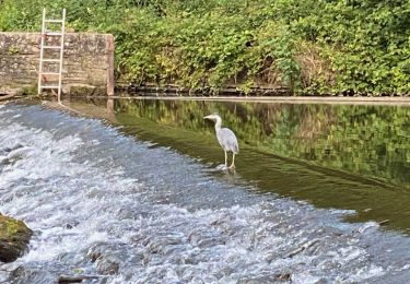
Localisation
Commentaires
Randonnées à proximité
![Randonnée Marche Bourscheid - Autopedestres : Bourscheid - Photo](https://media.geolcdn.com/t/375/260/ext.jpg?maxdim=2&url=https%3A%2F%2Fstatic1.geolcdn.com%2Fsiteimages%2Fupload%2Ffiles%2F1553511878bg_sport_marche.png)
![Marche Marche](https://static1.geolcdn.com/sitytour/trail-icons/101.png)
Marche
![](/images/other/stat-length.png)
![](https://static1.geolcdn.com/siteimages/upload/files/16400158638029165_repeat_loop_refresh_sync_direction_icon.png)
![Randonnée Marche Kiischpelt - eislek trail de Kautenbach à Troisvierges - Photo](https://media.geolcdn.com/t/375/260/fa22f2d8-d5f7-4d5a-bd3c-5a3522af9299.jpg&format=jpg&maxdim=2)
![Marche Marche](https://static1.geolcdn.com/sitytour/trail-icons/101.png)
Marche
![](/images/other/stat-length.png)
![](https://static1.geolcdn.com/siteimages/upload/files/16400158638029165_repeat_loop_refresh_sync_direction_icon.png)
![Randonnée Marche Kiischpelt - Eislek-pad Lellingen - Photo](https://media.geolcdn.com/t/375/260/b5d867db-7edb-46bc-9488-bc2835d5be2c.jpg&format=jpg&maxdim=2)
![Marche Marche](https://static1.geolcdn.com/sitytour/trail-icons/101.png)
Marche
![](/images/other/stat-length.png)
![](https://static1.geolcdn.com/siteimages/upload/files/16400158638029165_repeat_loop_refresh_sync_direction_icon.png)
![Randonnée Marche Kiischpelt - Éislek pad Kautenbach (1) - Photo](https://media.geolcdn.com/t/375/260/0c0135b5-3869-4e5e-9de6-2c826fdc4a40.jpg&format=jpg&maxdim=2)
![Marche Marche](https://static1.geolcdn.com/sitytour/trail-icons/101.png)
Marche
![](/images/other/stat-length.png)
![](https://static1.geolcdn.com/siteimages/upload/files/16400158638029165_repeat_loop_refresh_sync_direction_icon.png)
![Randonnée Marche Bourscheid - Éislek pad Bourscheid - Photo](https://media.geolcdn.com/t/375/260/22286de4-94ea-4b92-acbb-a4fc138a2ba8.jpg&format=jpg&maxdim=2)
![Marche Marche](https://static1.geolcdn.com/sitytour/trail-icons/101.png)
Marche
![](/images/other/stat-length.png)
![](https://static1.geolcdn.com/siteimages/upload/files/16400158638029165_repeat_loop_refresh_sync_direction_icon.png)
![Randonnée Marche Kiischpelt - Escapardenne Eisleck Trail: Kautenbach - Clervaux - Photo](https://media.geolcdn.com/t/375/260/86b391f6-6800-4c48-b33b-03a021b1a218.jpeg&format=jpg&maxdim=2)
![Marche Marche](https://static1.geolcdn.com/sitytour/trail-icons/101.png)
Marche
![](/images/other/stat-length.png)
![](https://static1.geolcdn.com/siteimages/upload/files/16400158638029165_repeat_loop_refresh_sync_direction_icon.png)
![Randonnée Marche Bourscheid - Escapardenne Lee Trail: Moulin de Bourscheid - Hoscheid - Photo](https://media.geolcdn.com/t/375/260/d49b1826-4b3a-4793-bf5a-6d813972bfaf.jpeg&format=jpg&maxdim=2)
![Marche Marche](https://static1.geolcdn.com/sitytour/trail-icons/101.png)
Marche
![](/images/other/stat-length.png)
![](https://static1.geolcdn.com/siteimages/upload/files/16400158638029165_repeat_loop_refresh_sync_direction_icon.png)
![Randonnée A pied Bourscheid - Autopedestre Schlindermanderscheid - Photo](https://media.geolcdn.com/t/375/260/b96de446-0e31-4144-a1e8-49f30dc2459e.jpeg&format=jpg&maxdim=2)
![A pied A pied](https://static1.geolcdn.com/sitytour/trail-icons/100.png)
A pied
![](/images/other/stat-length.png)
![](https://static1.geolcdn.com/siteimages/upload/files/16400158638029165_repeat_loop_refresh_sync_direction_icon.png)
![Randonnée A pied Tandel - Autopedestre Brandenbourg - Photo](https://media.geolcdn.com/t/375/260/f773c6ce-1e62-48fa-9c88-bf2c6a499187.jpeg&format=jpg&maxdim=2)
![A pied A pied](https://static1.geolcdn.com/sitytour/trail-icons/100.png)
A pied
![](/images/other/stat-length.png)
![](https://static1.geolcdn.com/siteimages/upload/files/16400158638029165_repeat_loop_refresh_sync_direction_icon.png)